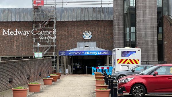
Medway's housing target reduced
Plus: How Medway maybe voted, Heritage Park HMO, winery battle gears up again, news in brief, and more


Housing is always a subject of debate in our towns, as large numbers of people regularly fight against developments in the midst of a chronic housing shortage. Now, with a change of government, mandatory housing targets are back, but with a different number to what we might expect. We take a look at what it means for Medway. Further down, we have the best effort yet at gauging how each part of Medway voted in the General Election, news of a planned giant HMO on the edge of a Heritage Park, and another round of the Cuxton winery battle appears to be upon us.
Editor’s note: Thanks to everyone who messaged with kind words following my Highly Commended award for Kent Print & Online Journalist of the Year at the Kent Press & Broadcast Awards last week. It was an honour just to be nominated in such a packed category, and I’m still kind of taken aback to have left with an actual award. Thanks so much for all of your support in reading, sharing, and subscribing to this thing over the past three years.
Medway has housing target (slightly) reduced
One of the new Labour government's big pledges was to get housebuilding going after years of under-delivery by successive governments caused a housing crisis across the country.
This reached a nadir during the previous government when mandatory housing targets for local councils were scrapped, meaning they could decide themselves how many homes to build.
Spoiler alert: This does not tend to go well for anyone needing somewhere to live.
One part of the plan is to designate some green belt land as grey belt and thus appropriate for development. This would primarily be previously developed land in the green belt and land that doesn’t contribute to any of its aims.
In Medway, this isn’t hugely relevant, as we only have very small areas of designated green belt, primarily west of Strood and Cuxton. No one seemed particularly inclined to build on it anyway. Other than winemakers, anyway, but more on that later.

The most meaningful shift was the reintroduction of mandatory housing targets, meaning every council will have to meet a set government number for new homes or face consequences from the government.
However, the government has created a new formula for the housing targets, meaning local councils are facing different numbers than they were under the former regime.
The new formula has many elements, and you are welcome to read the full thing, but the gist is that urban areas will largely face higher targets, and an affordability calculation feeds into it, too.
It’s hard to judge how effective the new calculation is at this stage, but at first glance, it does lead to some slightly odd results.
Medway, a fairly dense urban area with a chronic lack of housing and unaffordable rents (the calculation only takes in house prices, not rents), will now see a reduction in its housing target.
Under the old calculation, Medway was expected to deliver 1,658 new homes each year. Now, that figure is reduced to 1,644.
Admittedly, this isn’t a big change. It’s 0.8%, or to put it another way, it would mean a reduction of around 200 homes over the entire length of Medway’s proposed Local Plan period.
It does stand in stark contrast with the burden being placed upon surrounding local councils though. Swale is up by 2%, Gravesham by 4.8%, Maidstone by 10.1%, while Tonbridge and Malling is up a massive 28.9%.
Of course, none of this matters much if the homes don’t actually get delivered, and years of failure from the previous administration means Medway is still without a Local Plan and will likely be so until at least 2026. Even when the previous targets were in place, Medway failed to meet its obligation by a wide margin every single year.
Plans are positive, but actions are rather more useful. The government and Medway Council have a duty to deliver the number of homes that our area needs. Let’s see whether they manage to do it.
How Medway voted, maybe
One of the flaws in the General Election process for political data nerds like us is that, unlike in a local election, we have no idea of the localised trends that led to the results.
While we know Labour swept across all three Medway constituencies, we don’t know where the party made gains relative to previous elections or even compared to the local elections last year.
Step forward Ben Walker at the New Statesman, who has put together a model to demonstrate how votes were cast, ward-by-ward, across the entire country.
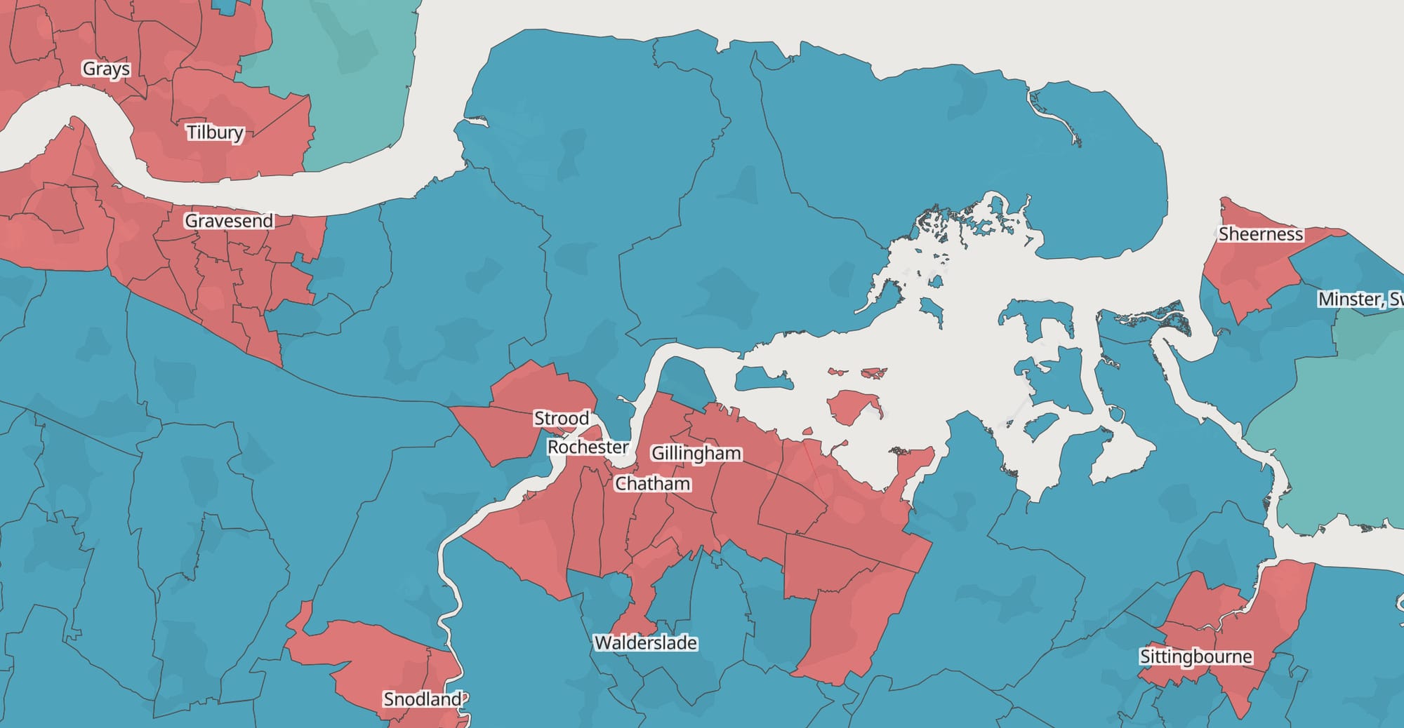
To be clear, there are many caveats to this. There is no public data, so the entire thing is an exercise in data modelling. The website explains in detail how this is achieved using demographic data, past local election results, voting samples, and the results we do have from the General Election.
As a result, it should be taken with something of a pinch of salt, and there is a fairly wide margin of error, but the trends are likely broadly correct.
So what do we learn?
The most notable thing is that the map above is very similar to the local election results from last year. Rochester, Chatham, Gillingham, and Strood all mirror the results of that election. The peninsula voted independent last year, but that wasn’t an option this year, so it seemingly reverted to the Conservatives, while Rainham saw three of its four wards switch to Labour.
Elsewhere, the results show Reform coming second in a hefty number of central urban wards, and little sign of any serious movement towards any of the other smaller parties.
There might not be anything hugely unexpected here, but it’s fun to play around with the map and pick over how Medway might be voting on a localised level.
Heritage park HMO
One of the more depressing aspects of Medway’s housing crisis has been the boom of HMOs (Houses of Multiple Occupation) in our towns.
Landlords have discovered they can make more money renting out individual rooms than entire properties, and desperate tenants scrambling for property at a rent that won’t bankrupt them end up living in them.

HMOs are supposedly regulated, but the reality is that many fly under the radar or are of such low standards.
Now, a developer has proposed to build a 30-room HMO on the edge of the Great Lines Heritage Park in Gillingham. The site is on the corner of Brompton Road and Marlborough Road and needs some improvement. The buildings on the plot currently used to be a nursery and a community centre but have since fallen into substantial disrepair.
Whether or not 30-room HMO is the answer is another matter. The plans offer just four living rooms and two kitchens for the 30 bedrooms and no other facilities on site. While some effort has been made to make the buildings slightly more interesting by adopting something of a chalet-style look, whether or not Medway’s planning committee look positively on a crowded HMO on the edge of Medway’s ‘heritage park’ remains to be seen.
Guardians of the Countryside: Volume 2
While Medway will be compelled to build thousands of new houses, what it isn’t compelled to build is anything nice. Such was the story of the Kentish Wine Vault.
The plans would have seen the largest winemaking facility in the UK built in Medway, housed in a landmark building by Norman Foster, with a restaurant, coffee shop, and visitor centre. The project would have brought significant economic benefits to the area, putting Medway at the front of the UK wine tourism market.
Of course, local residents campaigned against it, and the project was ultimately struck down by Medway Council and, later, the Planning Inspectorate.

Now, it appears each side is gearing up for another round as the developers attempt to push on with the plans.
Silverhand Estates, the company behind the plans, is proposing changes to get the project through planning. These include shrinking the building, removing the power centre (meaning the site will no longer be carbon neutral), and scrapping the car park in favour of a park-and-ride, which will result in more buses driving through Cuxton instead.
Of course, none of this seems to satisfy the locals, with the self-appointed Guardians of the Cuxton Countryside1. The 60-member group (Cuxton population: 2,600) believes the company is patronising them by trying to accommodate their demands, calling it a ‘vinicultural Disneyland’. Which sounds more like a positive than a negative, but maybe that’s just us.
These winery proposals are likely to remain controversial2, but it does seem like there is more hope for the company to succeed on a second attempt.
It seems more likely that the firm would get the plans through under the current Labour administration of Medway Council than the Conservatives of the past. We’ll find out soon enough once new plans are formally submitted.
In brief
🚣 Peel Ports are operating patrols in the River Medway to tackle antisocial jetski users. Recent incidents have included dinghies capsizing, swimmers being endangered, and bridge workers being intimidated.
🌿 A cannabis farm with 1,600 plants has been discovered at a premises on Canterbury Street in Gillingham. Police raided the location last week, and inquiries are ongoing.
🏗️ A £35m contract to redevelop Mountbatten House in Chatham is now out to tender. Medway Development Company are seeking a developer to convert and extend the building to house 162 flats.
🥇 Medway resident Nathan Hales won a gold medal today at the Olympics. Hales, from Chatham, won gold in the men’s trap shooting competition. As of writing, the result means Medway is higher on the medal table than Argentina, Denmark, Greece, the Netherlands, Nigeria, and Portugal.
More Authority
Over the weekend, we sat down with the third deputy leader of the Medway Conservative Group on Medway Council, Cllr Gary Hackwell. He ascended to the role following the resignation of Cllr Elizabeth Turpin and the promotion of Cllr George Perfect. We discussed what led him to join the Conservatives, what makes a good leader, and the fallout from the General Election.
 Steven Keevil
Footnotes
If you enjoy Local Authority, please share it with your friends, family, associates, and even your enemies. We have no meaningful marketing budget, so rely on word of mouth from our readers to find new readers. You can even get some sweet, sweet rewards for sending new readers our way. Details here.
Music that soundtracked the creation of this edition: There Is Nothing More Frightening Than The Passing Of Time by Superman Revenge Squad, Matchy Matchy by The Ballet, and All Hell by Los Campesinos!